| Modified: |
||||||
| Archaeological Research at Haft Tappeh | ||||||
| Deutsch | |||||||||||||||||
| Geographical Situation | History of Research | Historic Overview | Current Project | Bibliography | |||||||||||||
|
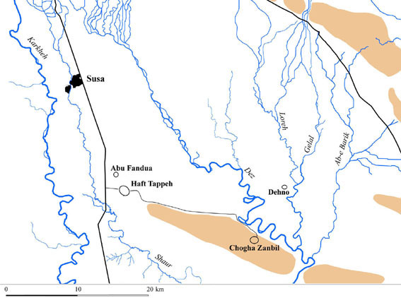
Geographical Situation
Haft Tappeh is situated about 18 km to the southeast of Susa in the province of Khuzestan in Iran at 48°19'47.56" east longitude and 32°04'49.06" north latitude. The site is formed from several small mounds. Therefore it is named in the Persian Language Haft Tappeh, which means “seven mounds”. The Persian word “Tappeh”تَپّه (mound / hill) is sometimes written incorrectly “Tepe”. Due to extensive agricultural activities during the last 40 years namely the systematic cultivation of sugar cane large areas of the antique site of Haft Tappeh were destroyed. |
|||||||||||||||||
 |
|||||||||||||||||
| Back to Home | |||||||||||||||||
|
(C) 2004 B. Mofidi-Nasrabadi
|
|||||||||||||||||